As efficient use of the Copernicus data and related systems of monitoring, today for the #internationalforestsday we are proud to share this exemple of cooperation within EU member states and timely European Alert System of the EU Civil Protection.
In 2017, the major of Ottaviano, Italy, understood that with their own civil protection tools they would not be able to contain the fires coming from the nearby forests. That is why, they decided to call the EU Civil Protection Service.
When the EU officer received the call from Italy, he diffused the alert message to all EU countries. France mobilised 2 firefighting Canadair planes straight away, while another EU officer based in Italy and working for the Copernicus Emergency Management Service, used the images of the area captured with the Copernicus satellite and sent the related maps to the Italian authorities. Thus, the firefighting team at the scene got the data and knew exactly where to focus their efforts.
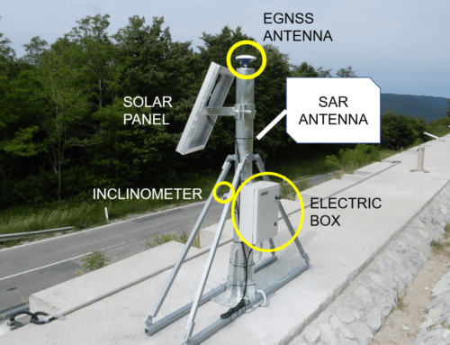
We are confident that GIMS will also save lives thanks to landslide live monitoring and alert system in the near future! Congratulations Europe!
Read more here https://lnkd.in/gixvUgZ